About KRGJSH

Summary information about KRGJSH.

Mission

ASIG aims to create networks that constitute the Geodetic Reference Frame of Albania (KRGJSH) with high accuracy to guarantee spatial reference according to European standards in all its components.

Purpose

KRGJSH aims to realize, through networks of benchmarks and permanent stations according to its constituent components, an unique geodetic reference system through which, are defined the planimetric position, altitudes, scale, gravity and orientation for any point of the territory of the Republic of Albania.

Sectors that use KRGJSH

The main sectors that support their activity in KRGJSH are:
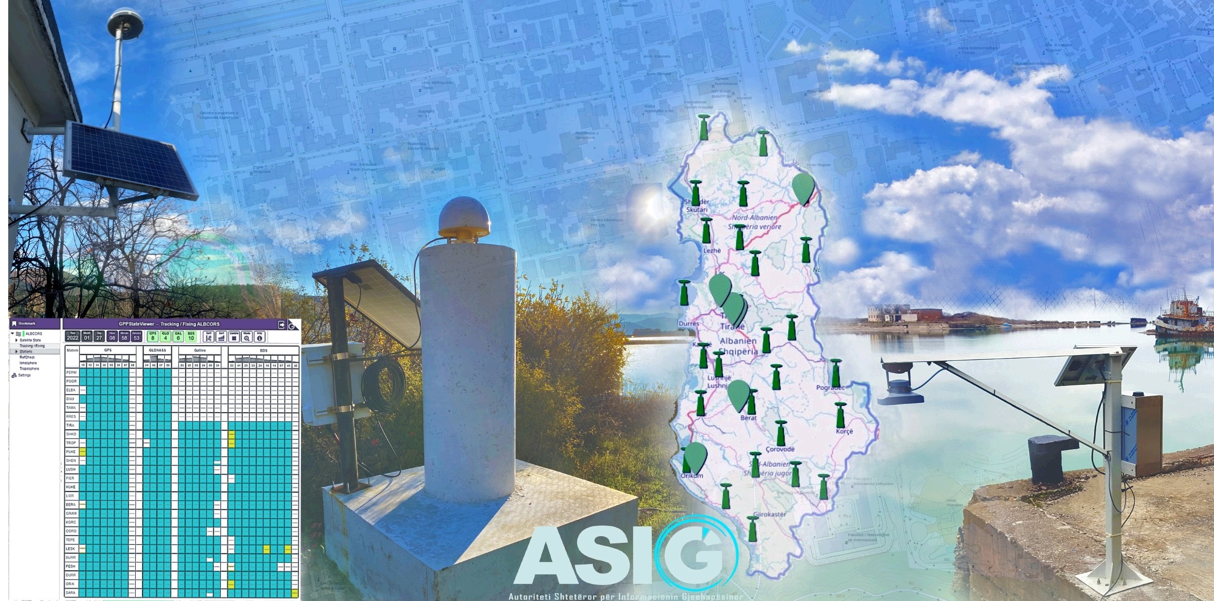
Establishment of the geospatial infrastructure of the Republic of Albania (NSDI), creation of topographic maps of different scales, creation of marine maps, in the definition of administrative boundaries, in the field of construction and in scientific studies.

5

KRGJSH NETWORKS

27

GNSS ACTIVE STATIONS

4

MAREOGRAPHIC STATIONS

4

GRAVIMETRIC ORDERS

OUR TEAM

                  KRGJSH SECTOR

GNSS

The active state network GNSS is represented by the GNSS ALBCORS network which enables a new realization of the European Land Reference System ETRS89 for the territory of Albania and at the same time serves for the maintenance of this reference for the territory of Albania.

As part of this network we have 27 CORS Stations built with concrete blocks.