Approval of law no. 72.2012: “On the Organization and Functioning of the National Infrastructure of Geospatial Information in the Republic of Albania” which approximates the INSPIRE Directive 2007 / 2KE of the European Parliament and the Council, and the establishment of the State Authority for Geospatial Information ASIG law as the institution responsible for implementation , laid the necessary legal and institutional bases regarding the design, construction, maintenance and updating of the Geodetic Reference Framework (RWC).
The requirements set by the INSPIRE Directive on the definition of geoinformation in a European spatial reference, a reference which plays a key role in the harmonization and interoperability related to information positioning, addressed in the other 33 topics of the Directive, has become one of the main commitments of ASIG.
One of the first bylaws initiated by ASIG and approved by the Albanian government in order to realize a modern geodetic reference with European standards for all users of geodetic coordinates in Albania was, DCM no. 669, dated 7.8.2013 “On the Approval of the Rules for the Determination, Creation and Realization of the Albanian Geodetic Reference Framework (KRGJSH), as a metadata. (Amended by DCM no. 322, dated 27.04.2016) ”.
This decision was followed by the approval of the Instruction of the Minister of Innovation No. 1, dated 06.09.2013 “On the determination of geodetic points with the help of Global Satellite Navigation Systems (GNSS)” and the preparation of a more detailed standard for the topic. “Determination of geodetic reference frame and geodetic control”.
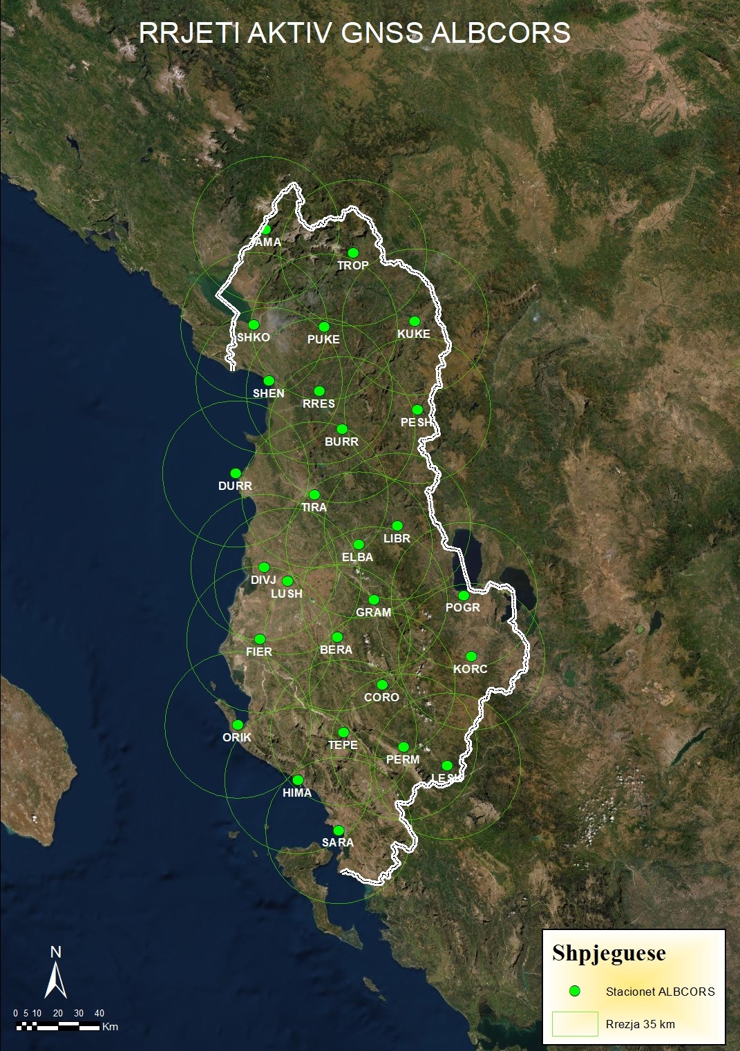
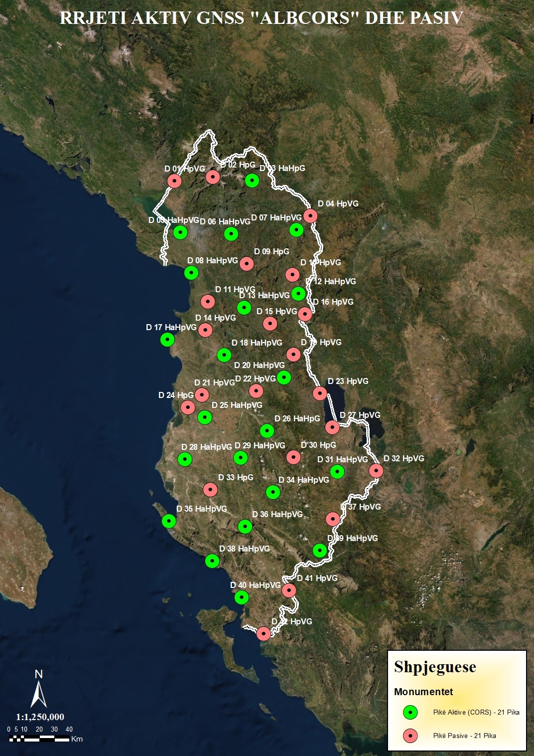
Based on these acts, the sector responsible for KRGJSH set up at ASIG is engaged in the construction of KRGJSH networks, combined between them, which should have common points, with the existing geodetic networks in Albania and with the existing networks which currently cover the territory of the European continent, to enable Albania to create a unique geodetic base that relies entirely on GNSS technology for efficient determination of the exact horizontal and vertical position of various points on the earth’s surface, above the surface and below its surface .
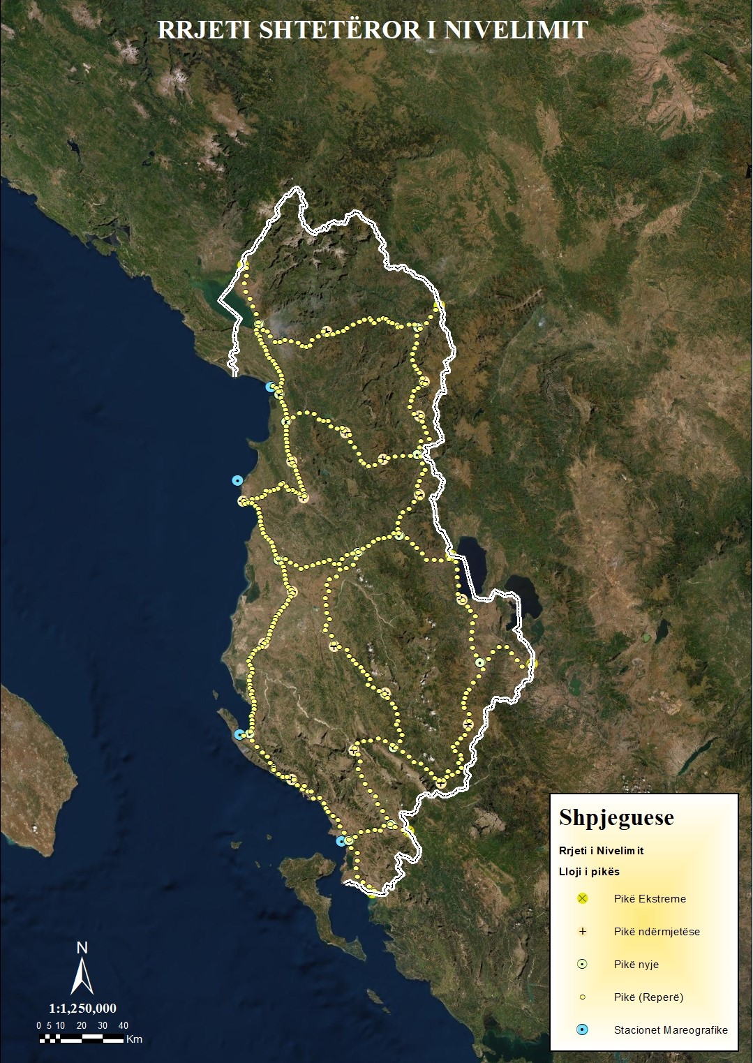
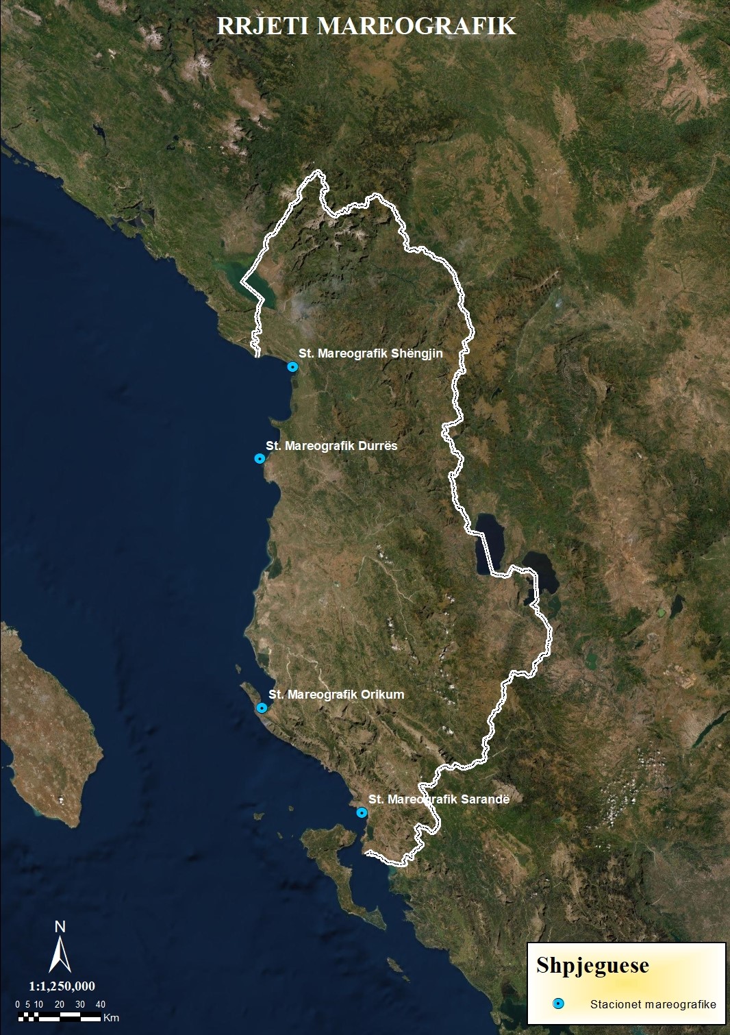
The unique geodetic base of the Republic of Albania includes the following networks:
- GNSS State Network;
- Gravimetric State Network;
- State Leveling Network;
- State Network of Mareographers;
- Network of Magnetometric Stations