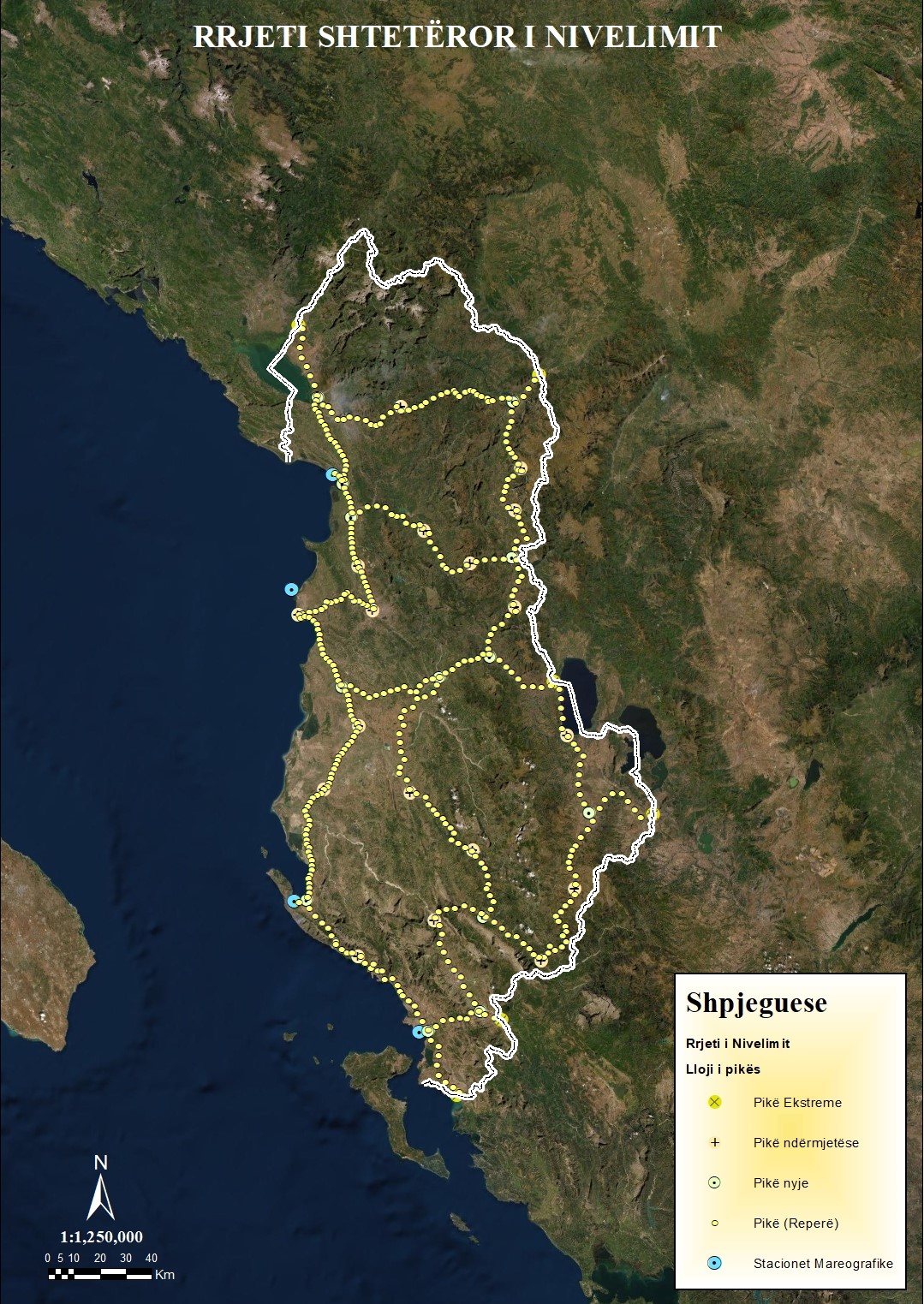
1. First Order Leveling Network
The first-tier leveling network will consist of 37 main points in total, of which 35 points are shared with the integrated points of the GNSS network and the Gravimetric network of the first order. The leveling lines are stretched along the main national roads (L ≈ 1800 km) which will be connected to the four mareographs at fixed points (TGBM).
The density of the points will depend on the areas:
– Areas with high development intensity (1 point every 2 Km)
– Mountain / rural area (1 point every 4 km)
– No. Repers (≈ 571)
2. Second Order Leveling Network (the leveling network with GNSS)
Second-level leveling network (GNSS measurement leveling network) that will enable the density of the First Order Leveling Network and will eliminate the need to build a leveling network according to the classical method and will serve as an alternative to determination of orthometric heights via GNSS / Levelling.