Magnetometric Network

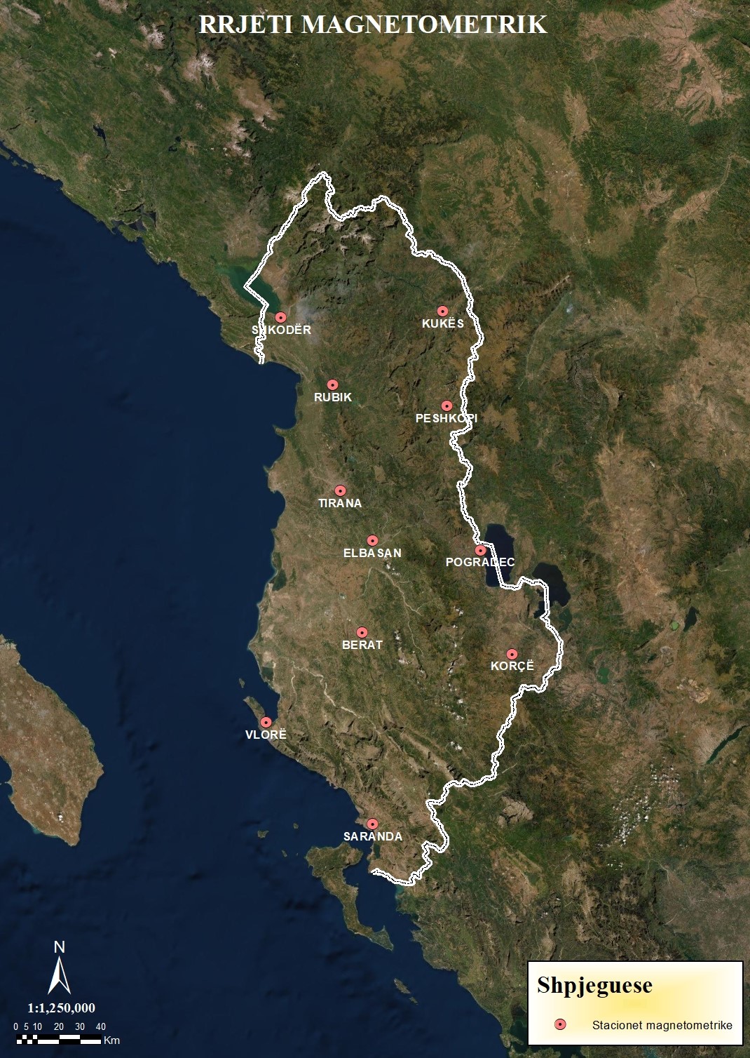
The State Network of Magnetometric Stations is a network of 11 Repetitive Stations in which the values of the components of the magnetic field are determined.

The main data of the components of the magnetic field are:

  • Declination (D)
  • Inclination (I)
  • Total Field (F)
  • Vertical component (Z)
  • Horizontal component (H)

The magnetic field data provided by periodic measurements at magnetometer network stations play an important role in creating and consolidating geospatial information in general and magnetic in particular, thus responding to international standards for spatial geoinformation within what is performed today for the Earth.

Nr.


LONGITUDE

LATITUDE

H (m)

I

D

F

ΔH(*)

ΔZ(*)

301

TIRANE

19° 49′ 44″ E

41° 18′ 55″ N

129.919

58°4’34”

4°50’22”

46810.0

24747.3

39731.7

302

SHKODËR

19° 29′ 16″ E

42° 03′ 03″ N

86.687

58°56’52”

5°12’28”

47037.4

24257.2

40298.1

303

KUKËS

20° 24′ 46″ E

42° 04′ 28″ N

347.861

58°55’20”

3°54’26”

47112.6

24313.7

40351.7

304

PESHKOPI

20° 26′ 02″ E

41° 40′ 35″ N

692.19

58°32’16”

4°14’47”

46933.4

24490.3

40035.6

305

ELBASAN

20° 00′ 43″ E

41° 06′ 08″ N

349.370

57°55’1”

4°7’52”

46744.8

24823.4

39607.0

306

KORCË

20° 47′ 34″ E

40° 37′ 11″ N

939.11

57°25’24”

4°15’46”

46618.7

25095.8

39285.3

307

POGRADEC

20° 36′ 46″ E

41° 03′ 48″ N

975.49

57°57’1”

3°56’44”

46727.7

24791.3

39607.0

308

VLORË

19° 28′ 48″ E

40° 24′ 00″ N

67.133

56°58’48”

4°4’23”

46481.7

25326.0

38974.5

309

SARANDË

20° 01′ 15″ E

39° 52′ 30″ N

80.339

56°33’8”

4°46’18”

46402.3

25573.4

38717.8

310

RUBIK

19° 46′ 55″ E

41° 45′ 55″ N

103.492

58°32’19”

5°39’14”

47164.3

24610.4

40232.2

311

BERAT

19° 56′ 45″ E

40° 42′ 51″ N

195.88

57°27’53”

4°16’38”

46636.4

25078.2

39326.7

Table of measured magnetic field values at magnetometer network stations for the 2017.5 era